Trail Maps, Directions & Links to Area Trails
A: Rideout from Site #1:
Saddle up from your site & ride to nearby national forest land
https://www.gaiagps.com/public/5bexvMwaV2E1QZ5ys6vYe9QF
B: Rideout from Site #2:
Saddle up from your site & ride to nearby national forest land
https://www.gaiagps.com/public/1huGivVaQm3gRbyQu5AYDzo9
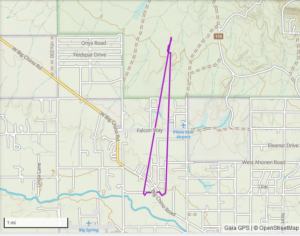
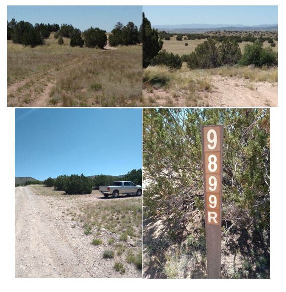
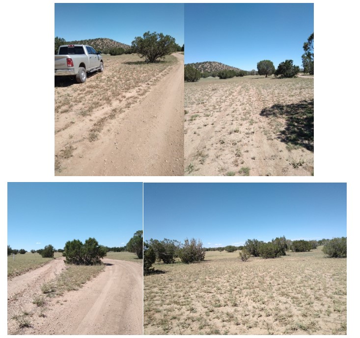
C: Feather Mountain Rd to National Forest Trail Ride
Directions:
Turn right out of driveway
Go to stop sign & turn right on Big Chino Rd
Go one mile, then turn left on Feather Mountain Rd
Go 1.7 miles, then turn right (slight right) on 9899R (look for ground sign in front of tree)
Go 1/10th of a mile and back into parking in front of “closed to motorized travel” signs
Multiple trails in the area, including trail leading from parking. Mostly a clean trail, rocky in some spots, room to go around rocks and ride near trail.
Views of Granite Mountain, Sullivan Buttes, Feather Mountain, high desert trees and rolling hills
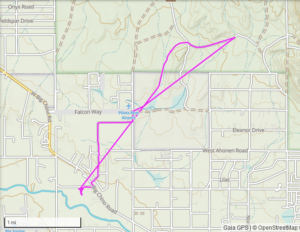
D: Upper Verde River Wildlife Area & Surrounding State Trust Land
Directions:
Turn right out of driveway
Go to stop sign & turn right on Big Chino Rd. Stay on Big Chino Rd for 3.2 miles (to stop sign)
Turn left onto Highway 89 (towards Ashfork)
Go .6 miles, then turn right on Verde Ranch Road (right hand turn lane)
Stay on Verde Ranch Road. Follow road to right & cross rail road tracks, it will turn to dirt and curve left. Turn on first road to the right. You’ll see a forest service kiosk sign about Upper Verde River Wildlife Area. 5.6 miles from Big Chino Ranch driveway.
Option 1: Park and ride: Park to the right of the sign & venture out on to state trust land for a ride.
Or turn right just past sign to continue to trailhead for 2.7 miles.
Option 2: Park at 6 miles. There is a triangle area on the left side for easy parking & turn around. Trails head out in both directions. Views of the Mingus Mountain, Bill Williams and trees. Maybe you’ll come across cows.
Option 3: Continue on to park and ride down to the Verde River. Note: the last ½ mile to trail head is slow and a little rough. Park in one of the open areas at 8.3 miles from driveway. There is a forest service trail head sign off to the right where the trail starts. Gate access is not far past the forest service sign. The gate is off to the right. Note: it is rocky when you go through gate.
Upper Verde River Wildlife area trail is 1 mile down to the water. The first ¼ mile is a little steep and rocky. Dismount & walk is an option. After ¼ mile, trail is wide, easy decent and smooth. Use the horse gate before the rectangle fence leading to the restroom area. It is a narrow opening with a fence bar at the bottom (this is to allow horses, but not atv’s.) Follow fence line towards the river (big trees off to the right), then go through one more horse gate. Ride to the left. Ride down to river, or the open field. Lots to explore in the beautiful canyon. There are restroom facilities & picnic tables.
Option 1: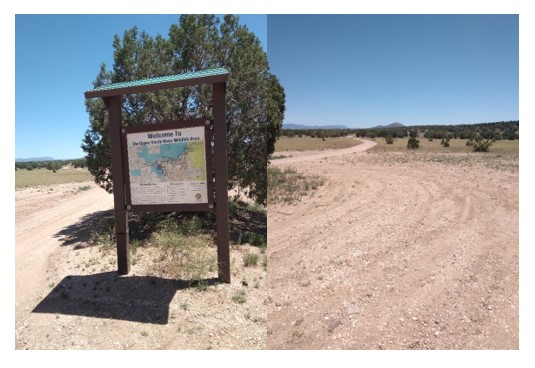
Option 2: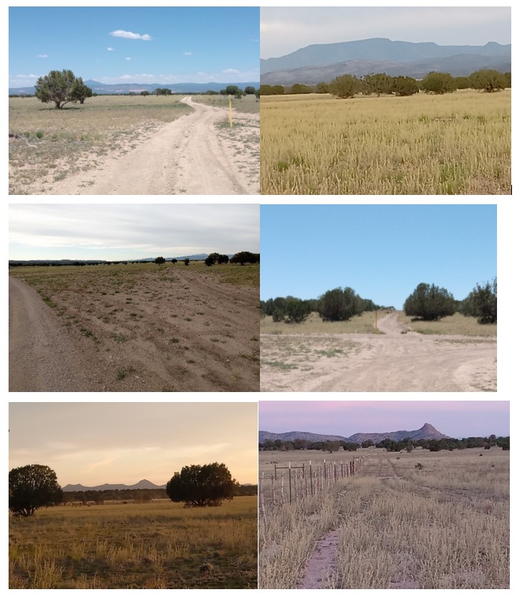
Option 3: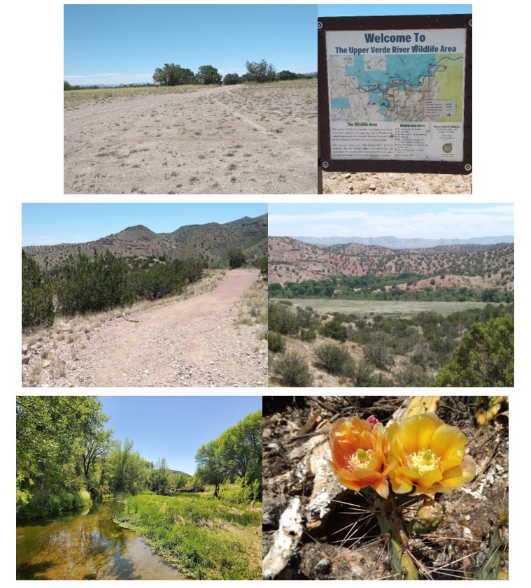
E: Sweet Valley Rd to State Trust Land
Directions:
Turn right out of driveway. Go to stop sign and turn right on Big Chino Road & go for 3.2 miles. (to stop sign)
Turn right on Highway 89. Go one mile. Turn left onto Old Highway 89 (across from Depot 89 gas station).
Take 1st left onto Sweet Valley Road. Go 1 mile on Sweet Valley Road and turn right on dirt road (road heads diagonally to right.) You’ll come to a V, continue right for ½ mile.
Park in flat area in a lightly weeded clearing on left. Ride in and out of trees while keeping road in site. Area is state trust land, you may see cows. Easy access, level riding and trees.
All Area Trails:
F: Williamson Valley Trailhead, Granite Mountain:
G: Thumb Butte Trails:
- https://www.fs.usda.gov/Internet/FSE_DOCUMENTS/stelprd3811861.pdf
- https://www.fs.usda.gov/recarea/prescott/recreation/horseriding-camping/recarea/?recid=80058&actid=104
H: Apache Creek Loop, Chino Valley: